

Death Valley National Park. A place that’s been high on my travel wishlist for as long as I can remember. The name is what intrigued me, but let me tell you – “death” is the opposite of what you’ll find here. The park is teeming with life, if one cares to notice.
The Timbisha Shoshone knew this for thousands of years before the European-American colonizers arrived. This was, and still is, their home. A place where they lived in harmony with the natural cycles of life. When Death Valley was established as a national monument in 1933, the Timbisha Shoshone were intentionally ignored. Please, if you don’t read this post, at least read about how the Timbisha Shoshone got part of their land back in 2000. It will open your eyes to the importance of this place.
As a visitor, I did my best to respect the land and to remember that I was merely a visitor. There is something incredibly special about this place, and can safely say that it’s one of my favorite places, ever.
This post is long (almost 100 photos) and is divided by areas of the park – not chronologically. I was in the park for four days and visited some locations several times (Badwater Basin, in particular).
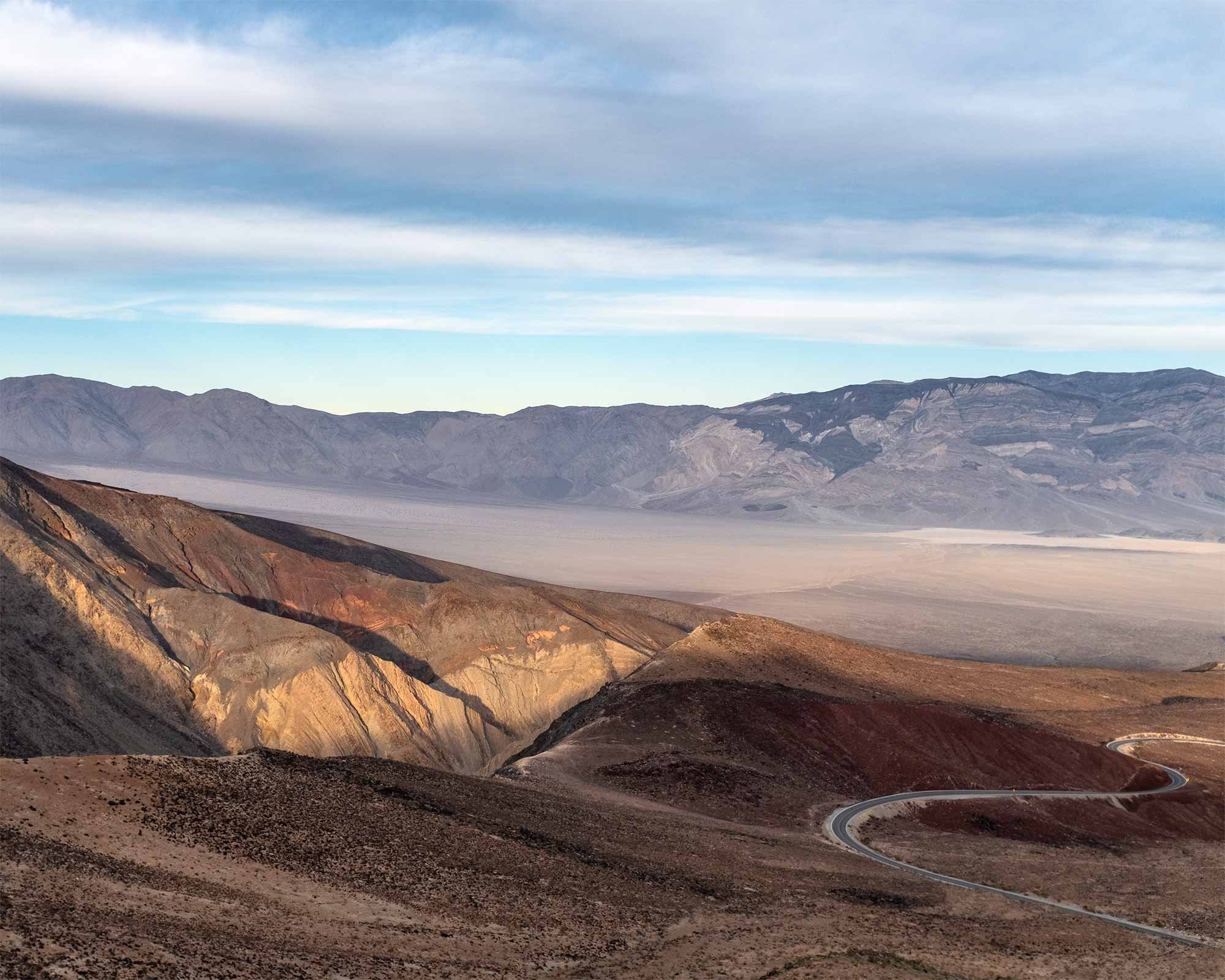
FATHER CROWLEY VISTA POINT
This was my first stop in the park, as I entered from the west. The drive from Palm Springs took longer than expected, so I didn’t get here until an hour before sunset. It was quiet and calm which put me in a melancholy, contemplative mood. I’ve written this before, and it happens on almost every trip. I don’t mind though. It’s part of my brain chemistry that I’ve come to terms with and have come to value.
Something super cool about this location. It overlooks Rainbow Canyon a.k.a. Star Wars Canyon. The U.S. Navy and Air Force both use the valley for low flight training. I didn’t see any, but sure heard them.


MESQUITE SAND DUNES
Where I stayed (Stovepipe Wells) was only a 5 minute drive from the Mesquite Sand Dunes…yay for “sleeping in”. Ha, not really. But I didn’t have to wake up until 5am to try and catch the sunrise.
Unfortunately, most of my time in Death Valley was cloudy, and this morning was no exception. The sunrise was pretty, but once the sun was up the clouds were already in. Sand Dunes are the most beautiful during the hour after sunrise and before sunset…if there’s sun. There’s still a beauty to the flat light in the dunes, but it’s different than what most photographers want to capture. The sun did peek out of the clouds for about two minutes at one point!
I was able to make it back for sunset on my last day at the park. Again, kind of a cloudy day but a little more sun.


The photo above is when the sun peeked out of the clouds! And the rest of the photos below were taken during a less cloudy day.


This is far from the last photo in this post, but it is the last photo that I took in Death Valley National Park.
BADWATER BASIN
Apparently, this is one of the most popular areas to visit in Death Valley. It sure was for me! I went four times during my visit and each time was a little different. The light was never the same, and something new always revealed itself.
There was no water in the basin during my visit, but sometimes there’s enough water that people can kayak through sections. The salt hexagons were quite cracked as well. It added a lot of texture but also treacherous walking. It’s easy to trip over one of these cracks, and the ground will easily cut through fabric…and skin. Still, totally worth it. Especially for sunset and moonrise.


ZABRISKIE POINT
There is no doubt that Zabriskie Point is beautiful. I’ve seen videos and blogs from only a handful of photographers who don’t recommend this area – and it’s only because of how popular it is. I really don’t see an issue with photographing popular spots. They’re popular for a reason! And there’s always a different way to tell the same story.
I was lucky that the sunrise was pretty decent on the first morning that I came here. The second morning…not as lucky. But that’s OK. The rock formations are incredible under any light. But oof…getting on the road at 4:30am to make it for sunrise was painful!


Even on a cloudy day, the rocks are yellow and beautiful!

MARBLE CANYON
Remember when I said that most of my visit to Death Valley was cloudy? Well, get ready for some flat light photos. Marble Canyon must be dazzling in the sun, but I still enjoyed the hike and rock formations.
The unique composition and pressure in this area formed walls of striated marble rock. Super beautiful. This was my first time encountering dry falls on a hike too. I almost turned around until realizing that you’re supposed to climb a few walls!
This day, the aircraft training was in full force. I even saw a few jets chasing each other at very low altitude. I heard many more jets than I actually saw. It was quite loud and busy. Looking back, I wonder if they were testing knowing that Russia was about to declare war on Ukraine?


DANTE’S VIEW
This was another 4:30am start for a sunrise. And once again, totally worth it. I was as prepared as possible for the wind and cold up here at Dante’s View, but not prepared enough! Within minutes, I felt like I was right back home in the Minnesota winter. At one point, my camera and tripod almost fell over from a huge wind gust.
Some cool background on this place. It was a filming location for the original Star Wars movie. Remember when Obi Wan Kenobi and Luke were gazing at the distant view of Mos Eisley? Yup, happened right here.


DEVIL’S GOLF COURSE
This area seemed smaller than most, but only because of the gigantic scale of Death Valley. The Devil’s Golf Course is a vast field of deadly sharp rock that has been eroded by wind and rain. Walking through the area is almost impossible and actually not recommended. Several park visitors have fallen and broken bones over the years.
If you listen carefully, you can sometimes hear pops and pings from the salt that form these rocks.


ARTISTS PALETTE
You can’t be everywhere at the ideal lighting time, and that was the case here. However, the different colored rocks are so saturated in some areas that it didn’t matter much.
To get to Artists Palette, you need to take a one-way, super curvy and super fun drive. Any motorcyclist or sport car owner would love to drive here!


UBEHEBE CRATER
Again, a cloudy day. I was pretty bummed since this location relies on good light for good photos. Once again, I photographed anyway.
Have I mentioned how much heights bother me? Unfortunately, the heights anxiety struck HARD for me here. There’s a great hike around the rim of the crater and everyone there was walking no problem…except for me. Even people in flip flops were able to walk with no care. But the combination of steep drop offs on both sides, the narrow walkway and the rocky path just waiting to trip an unsuspecting hiker made it impossible for me to walk more than 10 minutes.
If I ever get back here, I’m going to try the hike again.


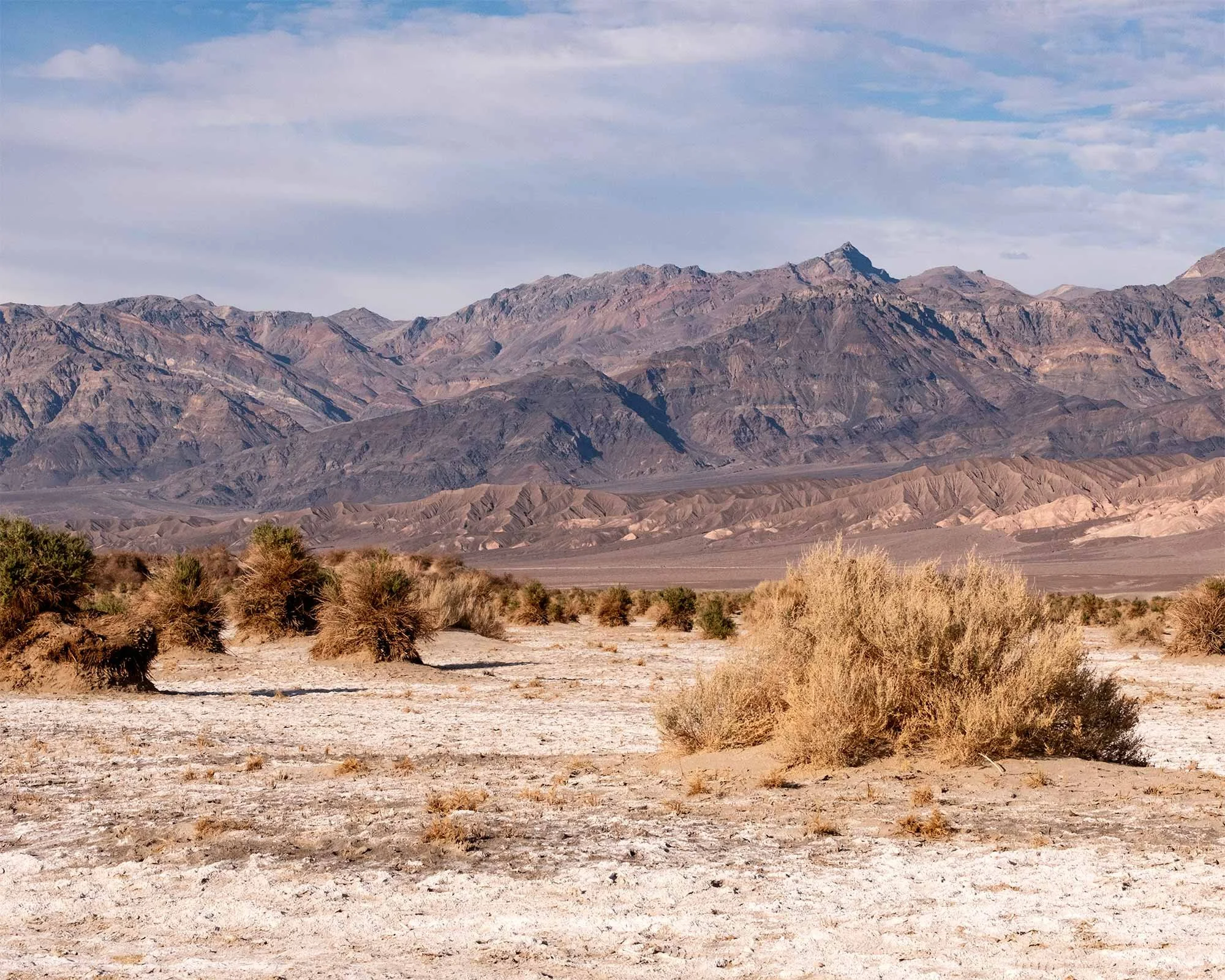
THE MOMENTS IN BETWEEN
It’s easy to get caught up in the major sites at Death Valley. But a huge part of experiencing this place are the moments in between – the liminal space if you will. This last section is scenes from driving and random hikes, all in chronological order.


One of the roads into Death Valley National Park.
If you got this far, thank you. And if you’re able, you may want to start planning your own trip to Death Valley National Park. You won’t be disappointed.